
Guidelines for submitting articles to Hacienda Riquelme Golf Resort Today
Hello, and thank you for choosing Hacienda Riquelme Golf Resort.Today to publicise your organisation’s info or event.
Hacienda Riquelme Golf Resort Today is a website set up by Murcia Today specifically for residents of the urbanisation in Southwest Murcia, providing news and information on what’s happening in the local area, which is the largest English-speaking expat area in the Region of Murcia.
When submitting text to be included on Hacienda Riquelme Golf Resort Today, please abide by the following guidelines so we can upload your article as swiftly as possible:
Send an email to editor@spaintodayonline.com or contact@murciatoday.com
Attach the information in a Word Document or Google Doc
Include all relevant points, including:
Who is the organisation running the event?
Where is it happening?
When?
How much does it cost?
Is it necessary to book beforehand, or can people just show up on the day?
…but try not to exceed 300 words
Also attach a photo to illustrate your article, no more than 100kb

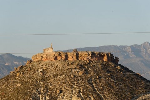
The castle of Alcalá in Mula
Mula, el Castillo de Alcalá
The town of Mula as we know it today owes its location to the Moorish invasion and occupation of southern Spain, which began in this area in 713 AD with the Pact of Tudmir and effectively ended in 1243 with the treaty of Alcaraz and the Christian Reconquista of southern Spain.
Mula existed before the arrival of a Moors, but in a different location; the original Mula is believed to have been in a place called the Cerro de la Almagra, 5 kilometres to the east of the modern town on the left-hand bank of the River Mula.
 This population centre had developed during the latter part of the Roman occupation of the area, (209 BC to 400 AD) and during the period of Visigoth rule, (6th century to 713 AD) had become one of the most important settlements in what is now the Region of Murcia. Such was its importance that it was one of seven towns mentioned in the pact of Tudmir when the Visigoth overlord, Tudmir, agreed a peaceful surrender of the Kingdom of the Levante to the Moorish invaders, (713AD) his co-operation securing his continued influence and safety as Governor for both himself and his heir.
The settlement had substantial fortifications and evidence has been uncovered of an established community, although the site is still only in the preliminary stages of excavation and investigation. It appears to have been destroyed at some point early in the 9th century, possibly during the disagreements among rival tribes at around the time of the foundation of the city of Mursiya (Murcia) in 825.
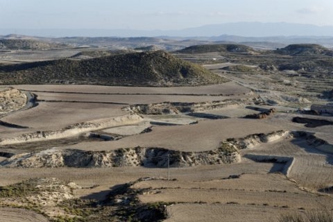 The location of the settlement was strategically important, dominating the routes inland and with valuable water supplies, as well as having been an important agricultural production area under Roman rule.
Although at this period in time it was common practice for one civilisation to re-use the settlements of the one they supplanted, La Almagra was abandoned totally at this point in history, evidence of ash layers discovered during the excavation process indicating that it was destroyed and burnt.
Two new fortifications were built later. Firstly, the Moors created a new settlement at the location of the current town of Mula at some point in the 9th and 10th centuries, although there is no documentary evidence to give an exact date when this happened.
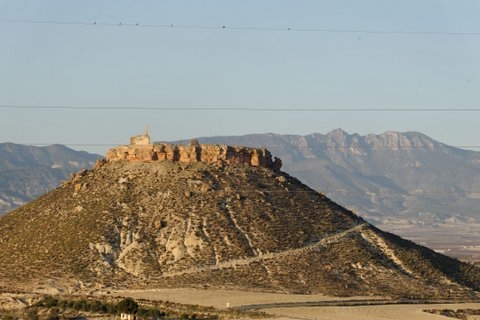
The second was a fortification built on a strategic outcrop guarding the approaches to Mula, close to the location of La Puebla de Mula on the opposite bank of the river from the Cerro de la Almagra, and this fortification became known as the Castle of Alcalá.
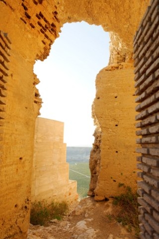
It is likely that a first rudimentary fortification was built in this location shortly following the signing of the Pact of Tudmir in 713, and that Moorish troops would have been stationed here, as although matters were very cordial between the Visigoth "wadi", or Governor, and the invaders, the control of strategically and economically important locations would not have been left to trust alone. By the 11th century there was a substantial fortification in this location.
This castle structure could have reached its current dimensions during the government of Ibn-Mardanis, known to his Catholic foes as The Wolf King, between 1147 and 1172, although there is no documentary evidence to support this. Almost the only certainty about the origins of the castle is its name, due to the existence of a document relating to the trial of a man for the murder of a warden in Albudeite: this is included in the "Libro de los Mojones con Albudeite", in which the castle is clearly named as being the likely home of the accused.
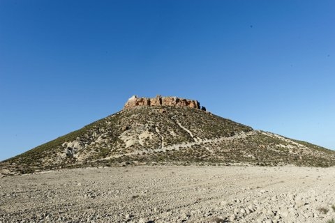
What is now the Puebla de Mula developed around this time, located at the foot of the outcrop upon which the castle was built. The castle stands 120 metres above the ground surrounding it, 369 metres above sea level, with perfect 360-degree vision for a good 12 kilometres.
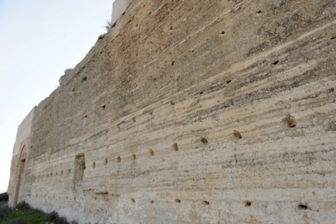
With little evidence of accommodation within the castle itself, it seems that the Puebla de Mula provided accommodation for the troops stationed there and acted as a collection and storage point for taxes and produce collected, although the Puebla assumed greater importance when the Christian Reconquista of the area in 1243 forced the Moors from Mula into the Puebla and Mula itself became a Christian fortification.
The castle itself was constructed on a natural rock step, with vertical walls more than 10 metres high creating a virtually impregnable fortification. The walls were built using a mortar base 1.5 metres wide, with an 80cm wide adobe brick shuttering system structure on top incorporating Roman building materials which may well have come from the site of the Cerro del Almagra below.
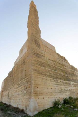 Its a considerable structure, measuring 125 metres wast to west and 90 north to south. The main structure comprises the considerable fortified walls, although today most of the visible remains relate to the towers and wall which protected the entrance to the castle.
The access gate is one of the oldest known in the Region of Murcia, formed by a double layered entrance, a narrow passageway with a barrel roof, and a double bend, making it easier to defend. This is the most compete part of the structure, measuring 25 metres by 13.5, with a height of 10 metres.
This part of the castle was following an earthquake in February 1999, which caused considerable damage, and during the restoration work the access road was created, enabling archaeologists to bring up materials. Although the road has deteriorated considerably since, it still provides a clear route up to the castle.
Following the repairs, exploratory trenches were cut into the ground, examining the site down to bedrock level.
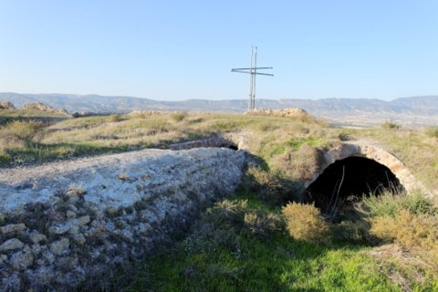
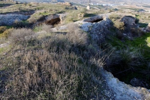
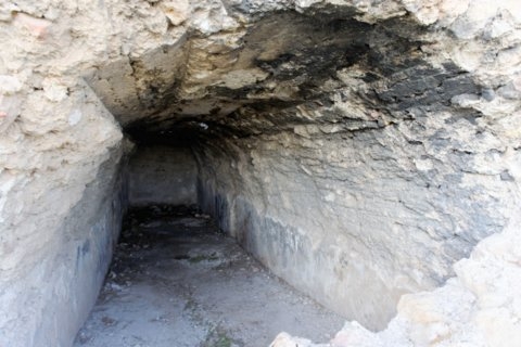
In addition to the walls, the castle contains 25 water storage cisterns and a deep well which reaches the water table of the river below.
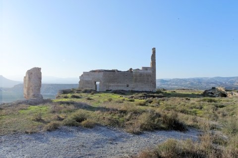
The area passed into the control of the Kingdom of Castile in 1243, forming part of the territories conceded to the young Prince Alfonso by the Treaty of Alcaréz. The castle was occupied by Christian forces and was mentioned in documents relating to the occupation of the Kingdom by the forces of the Kingdom of Aragón between 1296 and 1305.
 In 1333, the Concejo of Mula sold the fortress and the territitory around it to Alonso Yáñez Fajardo, a member of the family which became one of the most powerful in the Kingdom of Murcia, the Marqueses de los Vélez. It remained within the possessions of the family and their heirs until the 19th century, when the Duke of Bivona sold the land to Don Alfonso Chico de Guzmán but didn´t include the castle in the sale: the fortification was bought by José Ledesma Serra.
It was later sold to Don Joaquín Chico de Guzmán y Chico de Guzmán, Count of Campillos, and today is the property of Doña Maria Francica Monreal Alcaraz, of Puebla de Mula.
 Visiting the castle
The castle is located on the old road which connects Mula with Murcia. Drive south through La Puebla de Mula, which is on the C415A, heading towards Murcia, and once through the hamlet, the road dips down as it passes across the river gorge. Take the right hand turn for Librilla, and a short distance along the road there is a track which leads up to the foot of the hill. It is possible to park at the bottom, and then walk up.
The track is steep and cut away, so extreme care should be exercised. There is a cleared space just before the castle is reached which was used by the teams to carry out the repairs in 1999. Bear to the left when reaching this, and climbing up to the castle entrance.
Please note: this is not for the fainthearted! It is a steep climb, up a rough, washed away track. At the top there are no safety railings and the castle is not open to the public as an attraction, so visit entirely at your own risk.
 Those who are prone to vertigo are advised not to undertake the climb!
These locations are dangerous, great care should be exercised and the fragile nature of the remains respected. There are fences inside blocking off the well, but be extremely careful should you decide to visit and be aware that this is private property, and not a public attraction.

