
Guidelines for submitting articles to Hacienda Riquelme Golf Resort Today
Hello, and thank you for choosing Hacienda Riquelme Golf Resort.Today to publicise your organisation’s info or event.
Hacienda Riquelme Golf Resort Today is a website set up by Murcia Today specifically for residents of the urbanisation in Southwest Murcia, providing news and information on what’s happening in the local area, which is the largest English-speaking expat area in the Region of Murcia.
When submitting text to be included on Hacienda Riquelme Golf Resort Today, please abide by the following guidelines so we can upload your article as swiftly as possible:
Send an email to editor@spaintodayonline.com or contact@murciatoday.com
Attach the information in a Word Document or Google Doc
Include all relevant points, including:
Who is the organisation running the event?
Where is it happening?
When?
How much does it cost?
Is it necessary to book beforehand, or can people just show up on the day?
…but try not to exceed 300 words
Also attach a photo to illustrate your article, no more than 100kb

Cieza, Medina Siyasa
The 13th century Moorish town of Medina Siyâsa in Cieza
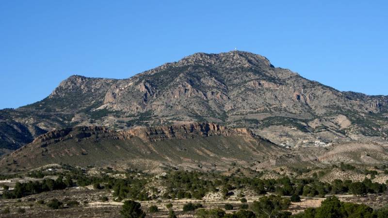
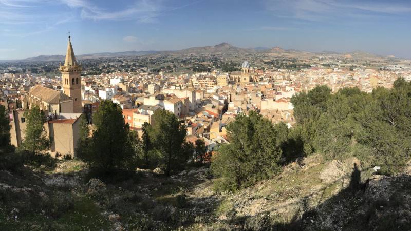
Cieza is the home of one of the best preserved 11th to 13th century Moorish town settlements on the Spanish 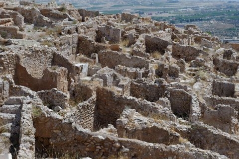 peninsula: Siyâsa, located 5km outside of modern day Cieza high above the town on the Monte del Castillo de Cieza.
Siyâsa is enclosed within a walled ring of protection covering an area of 11 hectares, ( although only 9 hectares of this was developed,) and based on the area excavated to date, it has been estimated that the town contained 787 houses, each of which had an average number of 5 occupants, giving an approximate population of 3,935 inhabitants at its peak occupation. This would have been a medium sized Islamic ( Moorish) town during the 13th century before the Moorish occupation of this area was broken by the arrival of the Christian forces of Castile in 1243.
The southern Iberian peninsula ( now Spain) was occupied by Moorish invaders from Africa in 711 and 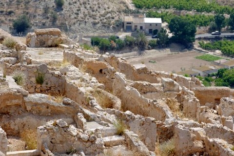 remained under Islamic control until the middle of the 13th century, although Granada was retained until 1492 when the Catholic forces of Isabella and Fernando finally completed the Reconquist and took the Kingdom. The location of Siyâsa allowed residents to monitor any movement in the valley below, giving ample warning of approaching danger or movements on the trade routes. Today the area below the site is flat agricultural land, but at this point in time there were large swathes of forest across the North-west, although these were harvested for building in the years following the Reconquist.
Siyâsa occupied a strategically important location, the Segura valley a natural communications route not only within the Kingdom of Murcia, but also between the Southeast and the interior of the mainland. The Segura River Valley linked the Vega Baja and the Campo de Cartagena with the coast, to the east the Sierra de Ascoy linked the Altiplano with the Valle del Vinalopó and to the west the river valley stretched out along the sierras of Segura and Alcaraz.
There were a number of routes passing along these natural valley curves, the principal one being the Roman  route from Cartagena to Chinchilla(Cartago Nova-Saltigi) and other Roman tradepaths, some resurrected by the Moors for their own use, and the first documented mention of Siyâsa is as an alquería( a small settlement) in the middle of the 11th century by the geographer al-Udri who mentions it as a stop-off point on the route between Cartagena and Toledo.
Throughout the 500 years of Moorish occupation, Spanish territories were not ruled by one single ruling dynasty, but a succession of different bodies. The first settlers in Siyâsa arrived during the era of the Caliphates, which lasted from 929 to1031 but by 1031 the unity had shattered and the kingdom had divided into a number of smaller kingdoms, ripe for attack from Christian forces who sought to recapture Spain from the invaders.
A new ruling power arrived from Africa in the shape of the Almoravids, who ruled for a further hundred years until 1130. By the middle of the 11th century, these political power struggles which had lead to the fall of the 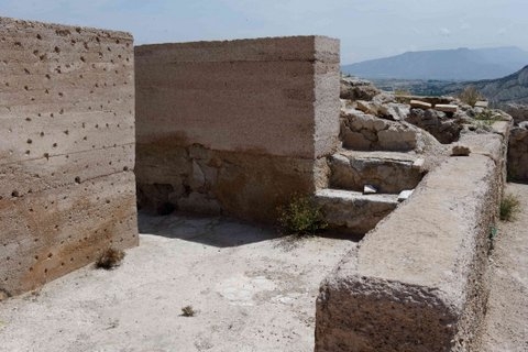 ruling Caliphate had started to impact on smaller communities and smaller rural populations began to gather closer together within the protective structure of fortifications, and towards the end of the 11th and beginning of the 12th centuries, the town of Siyâsa began to expand as its population grew.
Siyâsa was referred to as a dependent of the hisn ( fortress) of Ricote initially, but by the middle of the 12th century it is listed twice by Muhammed al-Idrisi ( a Muslim geographer, cartographer, Egyptologist and traveller who produced the most accurate map of the world in pre-modern times) on his journeys between Murcia and Segura and Murcia to Cuenca as being a hisn or fortressed town, with an alcazaba ( castle) of its own. Hisn is a phrase used to describe the size of a settlement between a qarya=alquería(small settlement) and madîna=ciudad ( or city).
The fortress of Siyasa had two distinct walled areas; an internal area surrounding the fortress itself, which was 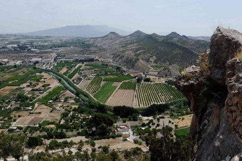 further subdivided, used as a last refuge for the townspeople in case of attack, and an external wall which encircled the settlement lower down on the rocky outcrop of the cerro, and provided elementary protection.
Within the external walls were a cemetery, public baths, shops and a mosque, the remainder of the hillside practically covered with private dwellings, with two main districts linked by a major street.
Agriculture was the major activity in the town, based on working the irrigation channels in the fertile plains alongside the River Segura, which stretched out at the foot of the outcrop on which Siyâsa was built, extending the original irrigation network built by the Romans who had also farmed this area.
The end of Siyâsa
Following the decline of the Almoravids , the rule of the Islamic Kingdoms fractured, offering opportunities for the forces of the Reconquist to push further South in their efforts to retake Spain. By 1243 there was little 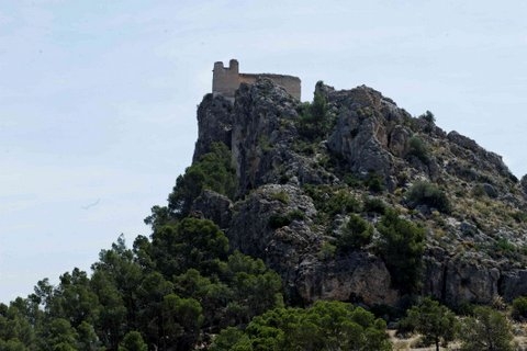 point in further resistance and the Treaty of Alcáraz was signed, passing the lands of the Kingdom of Murcia to the Castilian forces with Young Prince Alfonso ( later Alfonso X of Castile) at their head.( More info on this in the History of Murcia capital)
The treaty signed promised to respect the rights and customs of the resident Moorish populations, in exchange for taxes, and the right of the Castilians to occupy the fortresses and repopulate areas with native Castilians.
However, although the intentions may have been good, in practise the Moorish population were discriminated against and their rights abused to such a degree that by 1264 there was widespread revolt. Alfonso was forced to ask for help from his father-in –law, Jaime of Aragón, to help him deal with the uprisings across the Kingdom and it took 2 years to finally crush the revolt. There were mass expulsions following the revolts and thousands of Moorish residents left the Kingdom of Murcia, crossing the border into Granada, which remained under Islamic control until 1492.
There is no evidence of destruction within the ruins of Siyâsa, only abandonment, but whether the occupants 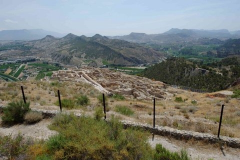 of the Medina were expelled, or moved elsewhere voluntarily is undocumented.
Early Christian settlers appear to have occupied the town for a short time, as alterations to the structure of the buildings, graffiti on the walls, changes in the structure of the hearths and even pig bones in the waste pits clearly show, but this was only for a short period as the new settlers abandoned the former town and built a new one in the location of present day Cieza.
As occurred in the case of the majority of fortresses across the Kingdom of Murcia, the castle was occupied by the Christian forces for their own use and passed into the hands of the Order of Santiago in 1281. Two centuries later it was destroyed in 1457 during one of several conflicts between the families of the Manuels and the Fajardos.
Following its abandonment , Siyâsa gradually imploded, and the ruins of the houses and buildings became buried under a thick coat of earth, and although its location was documented by several historians throughout the centuries which followed, it disappeared from sight as nature took over.
It wasn´t until the the 1980’s that archaeological excavations began to uncover this element of Cieza’s past. 19 houses were excavated, and a plan made mapping the walls and identifying the principal features of the town and walls.
Although the work stopped in the 1990’s, it was reinitiated in the early years of the 21st century, with EU funds from FEDER, the Regional government of Murcia, the Town Hall of Cieza and the Museo de Siyâsa.
However, maintenance and cleaning work is now only carried out on a very small scale due to lack of funding to excavate the whole site and the issues faced by uncovering these buildings and exposing them to the elements.
Moorish constructions used a good deal of soft materials in their decoration and finishing, and as such, are 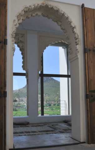 very susceptible to damage from the elements, and once uncovered, these buildings need to be protected from the sun and the rain. Until financing is available to protect the site, it is safer to leave the remaining hundreds of buildings covered by the earth and excavate further when sufficient funding is available.
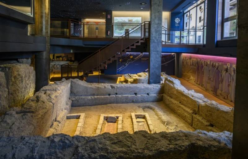
However, a vast number of artefacts and decorative mouldings have been removed from the site and are now displayed in the Museo de Siyâsa in the town below.
A visit to this museum is essential as part of a visit to the town, as two of the houses have been reconstructed in the museum exactly how they would have appeared when occupied, and totally change the perception of the visitor towards the site. The site guide will point out the two selected properties when visiting the site, and sitting inside the reconstruction looking up at the town across the orange orchards is quite a surreal experience, imagining life inside this house when it was originally built. It’s advisable to visit the site of Siyâsa first, then come down into town and visit the museum afterwards, giving a much clearer idea of the scale of the total site, as the area which has been excavated represents such a small percentage of the total area the town covered. However, conversely, having then visited the Museum, there is an overwhelming urge to return to Siyâsa and see it again through different eyes, appreciating just how large the settlement would have been when inhabited.
The structure of dwellings at Medina Siyâsa
The houses at Medina Siyâsa follow a typical model found throughout the Islamic world at this time, with an 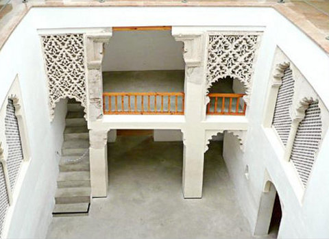 open central courtyard structure, giving access to the other areas of the house. In some cases the properties had a second floor, mainly comprising bedrooms, but the main communal rooms radiated from the courtyard on four sides, comprising kitchen, lounges, toilets, stables, store rooms and galleries.
There were no windows looking out onto the street, so light entered into the rooms from the central courtyard, giving the family within total privacy, and even the doorway entered into a double entry passageway to protect the inhabitants and the intimacy of the patio from a probing glance from the street.
There are two basic models of houses in Siyâsa: one of less than 50 m² and lacking some of the four sides of the patio, and larger properties with the four armed standard design, some of which covered a surface area of 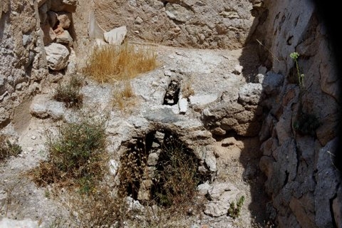 up to 200 m². As families grew, some properties were subdivided and any space available occupied, leading to total saturation within the inner town.
As can be clearly seen in the museum, the houses were very simple, yet had a stylish elegance, decorated with fretworks and columns. These gave light, but allowed privacy, and there are a number of different examples showing the styles generally used in the residential properties.
Water management was of great importance within Islamic towns, due to the necessity to maintain cleanliness, and the town has running sewers throughout, as well as water retention tanks within the town and castle. There may well be natural springs within the town area, as yet undiscovered, as well as the public bath houses.
The hisn or alcazaba. ( castle)
Although there was relative political stability, internal power struggles and the constant threat of attack from the Christian Reconquist forces meant that even properties high above the valley floor were not entirely safe 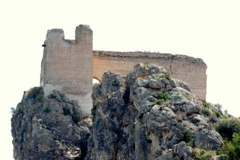 from attack, so defense was an important element within these Moorish settlements. The most important defensive tool was the castle, seated up high above the town, offering a last defensive position for the residents should the town come under attack.
As is normal in this type of defensive structure, the external walls contained very little buildings inside, other than accommodation for the soldiers and facilities to store and collect water : their main role was to offer a large protected space into which residents and their livestock could retreat should danger threaten. The Christians called this area the albacar in their texts written at this time.
But in this case there was a second, internal wall, which took advantage of the natural contours of the land to create a 2 tiered defence. The highest part of the rock structure held a tower, and was known as the celoquia.
At a lower level a wall surrounded the residential town area, offering an external defence.
The Cemetery
There is a separate cemetery area, located on a hill close to the principal entrance to the Medina. As is traditional, the bodies are lying on their side, facing Mecca.
Practicalities of visiting Siyâsa
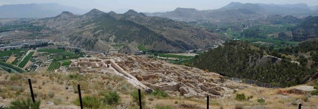
The Medina buildings excavated to date can be viewed independently through the perimeter fencing, and the external areas of the site explored on foot without a guide, but it is well worth visiting with a guide, to understand the scale and complexity of the site being visited.
Contact the Tourist office in Cieza to arrange for group visits. The site can be visited periodically by the public on a mixed group basis, with individuals able to book independently on specified days, but are only run in English by prior arrangement for groups.
It is possible to visit the site independently, but not enter into the excavated area. There is a small hermitage built on the edge of the site. Looking at the map, the entire area to the left of the hermitage would once have been occupied by structures: the area excavated is just a small section at the far end of the site ( 19 houses out of 787.) There is a good walk from the hermitage to the excavated area, so sensible footwear suitable for rough terrain is advisable, as is a hat on hot days.
To contact the Tourist Office via a safe contact box, Click Cieza Tourist Office
For more information about Cieza, go to the dedicated Cieza section, accessed via the map box at the bottom of every page or the town search box at the top of every page.


